Entry
Entry Dashboard
 Contacts
 Properties
 Email
Email Calendar
 Tasks
Tasks Acquisition Cockpit
 Audit-proof mail archiving
 Automatic brochure dispatch
 Billing
 Groups
 Intranet
 Marketing Box
 Multi Property module
 Multilingual Module
 onOffice sync
 Presentation PDFs
 Process manager
 Project Management
 Property value analyses
 Enquiry Manager
 Showcase TV
 Smart site 2.0
 Statistic Tab
 Statistics toolbox
 Success Cockpit
 Time Tracking
 Address from clipboard
 Text block
 Customer communication
 External Tools
 Favorite links
 Calculating with formulas
 Mass update
 onOffice-MLS
 Portals
 Property import
 Quick Access
 Settings
 Templates
 Step by step
You are here: Home / Additional modules / Marketplace / Provider overview / Geolyzer 2.0 - Integration of infrastructure data
Marketplace
Geolyzer 2.0 – Integration of infrastructure data
Geolyzer – Location that sells. Directly in the brochure.
Finally bring location to life.
With Geolyzer, you can integrate meaningful location and infrastructure data directly into your property – visually, CI-compliant and immediately exportable for your brochure. Free of charge as part of onOffice Enterprise.
Whether shopping facilities, public transport, leisure or individual favorite places:
The Geolyzer shows at a glance what really interests buyers – and strengthens your argumentation in sales.
▶️How the Geolyzer works
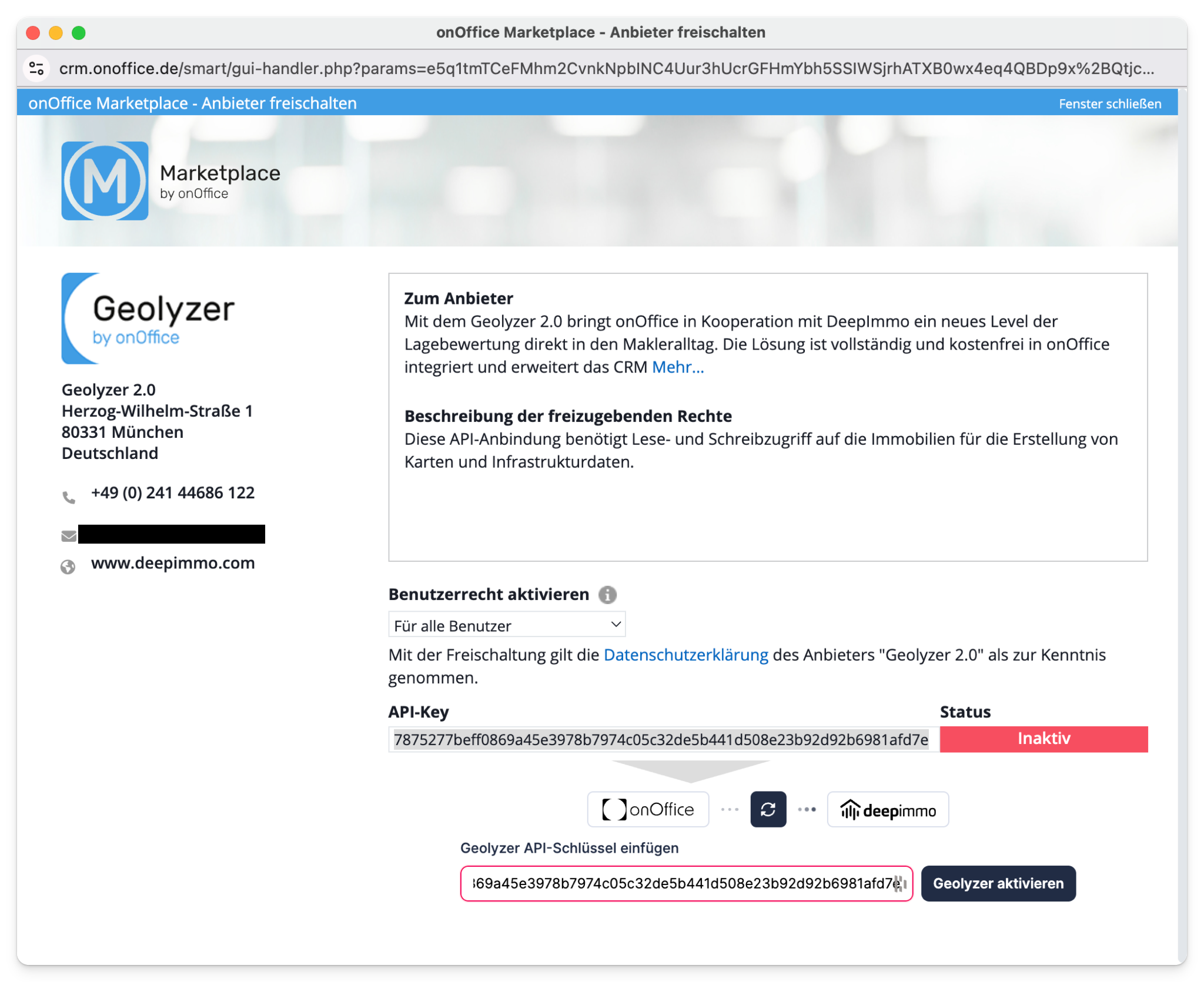
1. Activation & Start
The Geolyzer is activated directly via the onOffice Marketplace.
- Activate once
- Automatically available in the property
- No additional maintenance required
After activation, the Geolyzer appears directly in the location tab of your property.
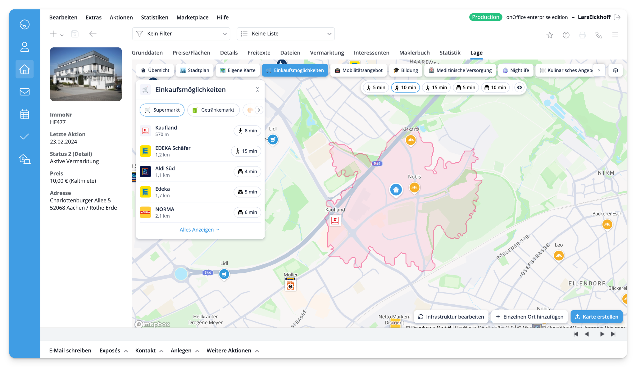
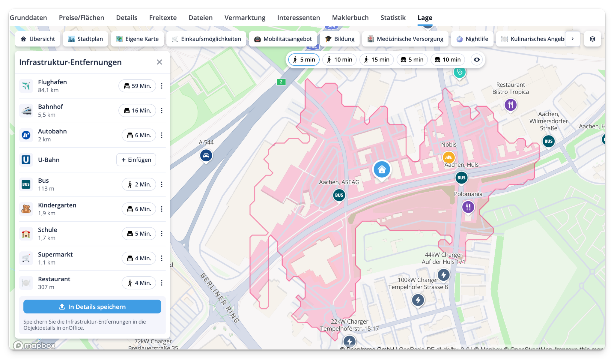
2. Discover the environment – the way buyers think
The Geolyzer analyzes the surroundings of your property intuitively and comprehensibly:
Typical categories:
- Shopping facilities
- Public transportation
- Sport & Leisure
- Traffic & Mobility
- Gastronomy
For each category you can:
- Simulate travel times (e.g. 5, 10 or 15 minutes)
- Change means of transportation (on foot, by car, etc.)
- Navigate to relevant locations
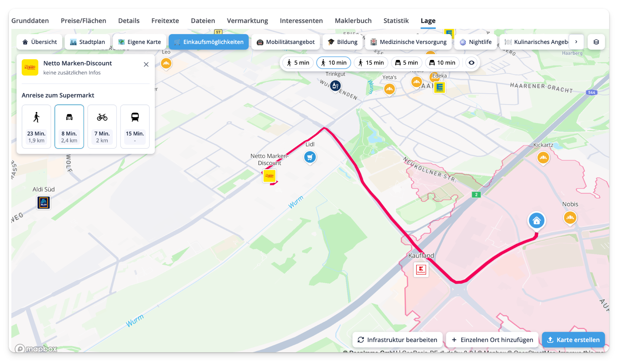
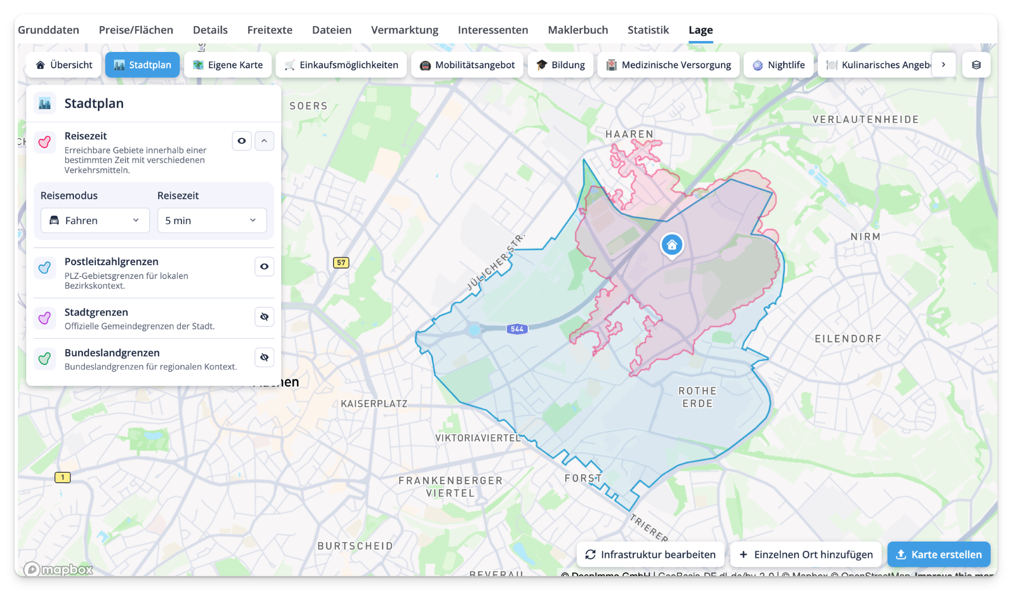
3. City map & visualizations
Additional information can be displayed on the interactive city map:
- Travel time zones (isochrones)
- Zip code areas
- City limits
- Individual zoom sections
This creates visual clarity – perfect for buyers who are not yet familiar with the situation.
4. Brochure-ready: Export site plans
Use the export function to create high-quality site plans for your brochure:
- Freely selectable image section
- Various formats & sizes
- Anonymize address or display as PIN
- Ultra-HD quality
- Automatic storage in onOffice or as a local download

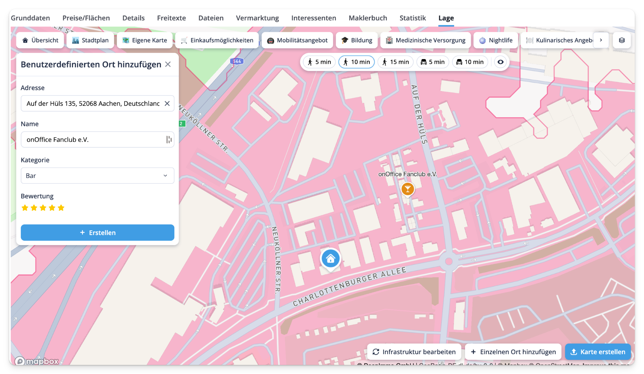
5. Add your own places – your story, your location
Do you know the situation better than any algorithm? Perfect.
With the Geolyzer you can:
- Create your own places (e.g. favorite restaurant, café, park)
- Assign these categories
- Edit or remove locations
- Show individual highlights in the brochure
Ideal for:
- Microlayers
- Trendy district
- Personal recommendations
6. Synchronization with onOffice
All relevant infrastructure data can be synchronized with a single click:
- Distances are updated at the touch of a button
- Data flows directly into the property details tab in onOffice
- Exported site plans are stored as files
This keeps everything consistent, up-to-date and traceable.
7. 100 % CI-compliant
The Geolyzer automatically adapts to your corporate design:
- Colors according to CI
- Property PIN in your colors
- Color-coordinated export layouts
Result:
A professional, brand-compliant appearance – without additional effort.
Conclusion: More location. More arguments. More contracts.
The Geolyzer is more than just a map:
✅ Better sales arguments
✅ Visually strong brochures
✅ Greater comprehensibility for prospects
✅ Clear added value in sales talks
In short:
Location becomes a selling point. Included free of charge in onOffice.